
Tuesday, June 26, 2016
Posted from: West Glacier, MT
Miles driven: 214
Total trip miles: 8,022
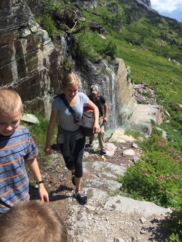
We started off early today knowing we were headed for a popular hiking spot. We drove the Going to the Sun Road again, but kept going to get to the Many Glacier area. We planned to hike awhile on the Grinnell Glacier trail. The trail is 11 miles round trip, but we planned to just walk 3-5 miles of it.
Here is a picture of the jagged rocks that people lose their mirrors on like the guy who lost his yesterday. We saw his mirror on the side of the road this morning as we drove by.

I don't know the name of this mountain or glacier. To be honest, we just pulled off here to use the restroom and decided to snap this picture. So there it is.


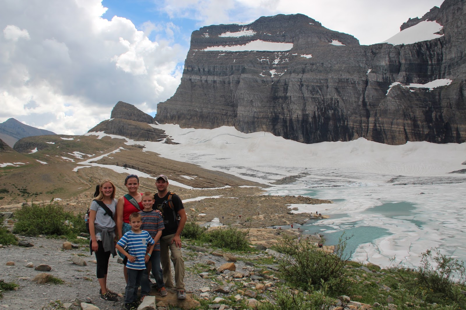
We took this picture with the Grinnell glacier in the background so if the kids came back later in life they could do the same and compare the size of the glacier...if it is still there.

It was worth it. This is Upper Glacier Lake. If you look really close on the ridge that dips down up on the mountain, you will see people walking. They are on a side trail that leads off the Highline Trail. That is a 20 mile (one way) trail. The trailhead is at Logan Pass. This trail is as highly recommended as the trail we were currently on. Two best trails in the park.


This is the storm we were worried about. While we were walking down to the lakes edge, the wind picked up and it started sprinkling. There was a park ranger up there who had just finished a ranger led hike (a hike we thought about doing, but we weren't going to hike this far today...or whatever). She was encouraging people to watch the weather and head down for safety. Basically: "I'm the one that is going to have to save your butt if you are not smart, so use your brain people!"


We saw what we came to see so we happily began our trip down. The thunder assured us we would get wet. And we did. This is the last picture because all electronics (the Canon, cell phones) were put away in our waterproof compartments. (We plan for everything.)

We got wet coming down, but it was so much fun. The rain really brought out the color in the rocks and flowers. There also wasn't much shade on the hike, so the clouds and rain felt good to us.
We met a lot of great people on the hike. When you are on longer day hikes, you become part of a community. You watch out for the others traveling with you. You tend to leapfrog the same people when you take breaks or when they do. If someone has a problem, you help. You discuss the weather and if you should continue. You take pictures for each other. You warn of tripping hazards to those behind you. You provide encouragement when there is just a little way to go and it is hard.
We had a couple with a 15 month old on this hike. She was in a child hiking backpack that mom carried all the way to the top and back down. Superwoman.
There was a couple retired gentleman hiking with us too. Once we were within a mile of the trailhead on the way back we talked with them the rest of the way.
We arrived back at the truck tired but happy. We had just hiked 11 miles with an assent of 1600 ft. And saw some of the most beautiful scenery of the entire trip.
We stopped at the St Mary visitor center so our Junior Rangers could get sworn in. They also got a sticker for all of the hiking they had done.

We were all feeling pretty sore when we arrived at the visitor center and then back at the campground. I had to ice my knee for a short while. But the kids quickly forgot about their hurts and began playing with their new friends.

We were all feeling pretty sore when we arrived at the visitor center and then back at the campground. I had to ice my knee for a short while. But the kids quickly forgot about their hurts and began playing with their new friends.
Matt and I didn't even need to discuss dinner. He asked where the closest carry out pizza place was as if he was reading my mind.
We let the kids stay up late to spend time with their friends. Tomorrow would be a travel day so they could sleep then.


No comments:
Post a Comment